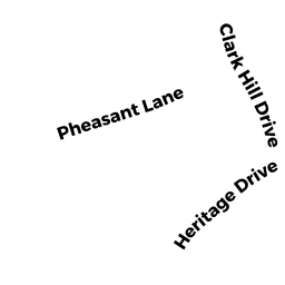
22 CLARK HILL DRIVE
Owner Information
AKILLIAN THOMAS Z. & ERIN M.
22 CLARK HILL ROAD
NORTH EASTON, MA 02356


Property Details
22 CLARK HILL DRIVE is classified as a Single Family Residential (Colonial).
The primary structure on this property was built in 1977. There are 5,880ft2 of built area within this property. There is 3,448ft2 of residential/living space within this property.
22 CLARK HILL DRIVE is valued at $637,000. The land is valued at $273,900 and the structures are valued at $360,600. There is an additional valuation of $2,500 on this property.
This property is in Zone RES. Confirm with local Zoning Board authorities to ensure there are no overlays or other easements on this property.
The most recent deed for 22 CLARK HILL DRIVE is recorded at the local registrar in Book 27348, Page 294. 22 CLARK HILL DRIVE was last sold on Wednesday, September 15, 2021 for $769,900.
Assessment data from fiscal year 2022.
Flood Data
According to the FEMA National Flood Hazard Layer, this property does not appear to be in a flood zone. It may also be in an area not yet reviewed. Nonetheless, confirm this information prior to taking any action.
To view the flood hazards around this property, create a FEMA "Firmette" Map of the area around 22 CLARK HILL DRIVE.
Broadband Internet Providers
| Provider | Type | Bandwidth (mbps) | |
|---|---|---|---|
| VSAT Systems, LLC. | Satellite | 2 | 1 |
| GCI Communication Corp. | Satellite | 0 | 0 |
| T-Mobile | Fixed Wireless | 25 | 3 |
| Comcast | Cable | 1000 | 35 |
| Verizon New England Inc. | Fiber | 940 | 880 |
| Viasat Inc | Satellite | 100 | 3 |
| HughesNet | Satellite | 25 | 3 |
Broadband service provider data from December 2020.
Adjacent Properties
- 10 SHERWOOD DRIVE
Developable Residential Land owned by LEONARD JANET ELAINE - 6 SHERWOOD DRIVE
Potentially Developable Residential Land owned by LEONARD DAVID ROBERT - 26 CLARK HILL DRIVE
Single Family Residential owned by HOLMES FRANK & KIRSTEN J - 18 CLARK HILL DRIVE
Single Family Residential owned by HARLFINGER HEIDI L